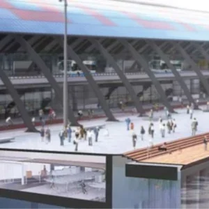
The West Island Line (WIL) will extend the Mass Transit Railway Corporation (MTRC) Island Line (ISL) from the existing Sheung Wan Station to the western district of Hong Kong Island, and add approximately 3.3km of underground route to the existing Line. Three new underground stations, Sai Ying Pun Station, Hong Kong University Station and Kennedy Town Station, will be built along the line. Kennedy Town will be a cut and cover station, and Sai Ying Pun and Hong Kong University will be deep cavern stations. Figure 1 (far right) shows the underground view of the WIL.
Selection of a cavern option was primarily on account of the lack of available land in the densely populated areas of the western district. The alignment was conceived following evaluation of a number of alternatives taking into account the physical constraints (for example existing buildings and their foundations), the need to connect the three new stations to the ISL west of Sheung Wan Station and the need to locate the caverns within a competent rock mass. The depth of the proposed cavern stations vary between 50 and 80m below ground level.
The two WIL caverns will be the first station caverns built by MTRC for over 25 years and will be the first caverns of these spans to be built beneath Hong Kong’s densely urbanised areas. There was little local precedent to guide development of the design concepts, which also had to be developed under close scrutiny from Buildings Department and the Geotechnical Engineering Office. Experience with cavern engineering from overseas was combined with knowledge of local practice and design standards to produce an approved reference design.
Site condition and structural geology
The proposed Sai Ying Pun Station cavern is located beneath the colluvium-covered sloping ground at the foot of Victoria Peak, beneath the Centre Street and High Street area. More than 30 buildings constructed on various types of foundation, such as friction piles, end-bearing piles and pad footings, are located above the footprint of the cavern. The station is orientated in a southwest-northeast direction with the ground level dipping steeply towards the north from over 50m above Principle Datum (mPD) in the southwest to less than 30mPD in the northeast.
The proposed Hong Kong University Station cavern is located in an area of sloping ground to the north of Lung Fu Shan, beneath Pokfulam Road, with a number of existing buildings around the area. The cavern is orientated in an east-west direction, and ground levels decrease from +80mPD at the western end to less than +40mPD at the eastern end.
The published geological maps of the region indicate the overall trends of faults with northeast-southwest and northwest-southeast orientation. Hong Kong University Station has an east-west orientation and is therefore intermediate to each of the trends, while Sai Ying Pun Station is sub-parallel to the dominant northeast-southwest trend. No major faults are shown in the vicinity of Sai Ying Pun Station and a single fault with a northweast-southwest orientation is shown just to the south of Hong Kong University Station, which if extrapolated towards the northeast intersects the eastern end of the cavern. A number of other lineaments, representing possible geological structures had been identified by studies of the topography and aerial photographs (MTRC, 2008a).
Both vertical and inclined boreholes were planned to investigate the rock mass conditions. The aim of the inclined holes was to provide data on the subvertical structures, including major structures and faults which could impact on the stability of the cavern excavation. However, due to access difficulties and the presence of existing buried utilities, complete coverage of the cavern areas was not possible. The evidence for most of the inferred geological features was limited. However, one of the inferred features predicted to intersect the eastern end of the Sai Ying Pun Station cavern and platform tunnels was encountered in several boreholes. This adverse geological feature was characterised by closely spaced structure and altered material some 0.7m thick. The eastern end of the Sai Ying Pun Station cavern thus comprises a shallow rock cover of partially weathered rock mass intersected by an altered adverse geological feature. In order to investigate this feature further and to provide an opportunity for detailed characterisation, and also if necessary to undertake treatment, an advanced pilot tunnel, from the construction shaft at King George V Memorial Park was recommended. The pilot tunnel will form a part of the permanent works for access.
Cavern layout
The Sai Ying Pun Station is 225m long and comprises a 187m long cavern and a 38m long platform tunnel extending from the northeastern end. The cavern is located approximately 40 to 65m below ground. It has an excavation span of 22.8m and a height of 16m, and will be built with a moderate rock cover of 50m at the western end and a rock cover of only 10m at the eastern end. In view of the shallow rock cover at the eastern end of the cavern construction, two-finger platform tunnels with a reduced size of approximately 9.5m in width and 10m in height have been proposed. The platform tunnels will be separated from one another by a 3m wide rock pillar.
The Hong Kong University Station comprises a 240m long cavern with an excavation span of 22.4m and a height of 16m. The overall depth of the cavern is similar to that of Sai Ying Pun Station and varies between 48 and 80m below ground level. However, the rock cover is greater and is anticipated to be around 65m at the western end and 25m at the eastern end of the cavern.
The orientations of the caverns were governed by the existing Sheung Wan Station and its overrun tunnels, allowable turning radius of the railway line, physical constraints of existing structures and their foundations, and the location and depth of competent rock. A further review of the geological data at the detailed design stage concluded that shifting the position of the Sai Ying Pun Station cavern 50m towards the west would increase the rock cover significantly and hence reduce the risks associated with cavern construction. However, because of the railway operational constraints on cant and curvature, as stipulated in the MTR Design Standard Manual on railway engineering design, the station was shifted 18m to the west.
The various rock pillars associated with each cavern were designed taking into account the anticipated quality of the rock mass, joint orientations, and the width and height of the adjacent cavern and adits. Stress concentration and distribution at each construction stage were estimated. The derived layouts have a pillar width typically a half to two-thirds of the tunnel cavern height (GEO, 1992).
Cavern design concepts
Excavation sequence and support The cavern will be excavated using drill and blast methods with temporary support to enhance the intrinsic stability state in order to provide adequate stability reserve at all stages of construction. Temporary support will comprise rock reinforcement and shotcrete installed in the crown and sidewalls incrementally as the excavation proceeds. The supports will also be installed within a specified distance from the excavation face in order to benefit from the support provided by the excavation face and to maintain confinement. The maximum advance will be varied according to the ground conditions and proximity of adjacent openings. Rock bolts and shotcrete, which can be installed quickly and easily, were adopted in the reference design. Preliminary excavation sequences of the caverns themselves together with those of their adjacent adits were developed in the design. Development considered the benefits of various sequences in terms of rock engineering and maintaining stability, access from side adits to the main opening and considered construction issues including typical plant size for the installation of rock bolts with reference to the height of the top heading.
Selection of drained versus undrained lining
The key design consideration for both caverns, which has far reaching implications for the overall cavern design was the selection of design concept in terms of a drained versus undrained permanent lining system. In drained lining systems, a mechanism for the relief of water pressure on the lining is provided which results in an economical design in terms of the thickness and reinforcement content of the lining. By contrast, an undrained lining system requires the full water pressure to be supported by the lining, which increases the structural thickness. Straight side walls become difficult to engineer due to the quantity of reinforcement required and a curved invert and base slab are required. As a consequence excavation volume and the cost and complexity of construction are all increased.
A drained system is permanently pressure relieved and allows flow of groundwater into the cavern, which could cause a drawdown of groundwater levels in the superficial materials in the long term. This has implications for settlement and potential consequences for buildings and structures. This risk is particularly pertinent to Sai Ying Pun Station, located in the centre of Sai Ying Pun where many old buildings are built on a variety of foundation types including settlement sensitive friction piles.
A hydrogeological assessment was undertaken to study the potential impacts of drained caverns and to examine the influence of depressurisation on the hydrogeological regime. The results suggested that a drained cavern concept would be feasible for both Hong Kong University Station and Sai Ying Pun Station. A drained system was therefore designed and accompanied by specifications for groundwater control during construction, including for probe holes and water inflow criteria to govern pre-excavation grouting requirements; a comprehensive instrumentation and monitoring scheme; and a grouting design at critical locations.
To reduce the risk of groundwater pressure build up on the lining with time, the design includes the installation of a highly conductive geotextile behind the lining to facilitate inflow of water from the surrounding rock mass to a drainage invert of 300mm thick rock fill. Collected water will be diverted to a sump via drainage pipes located along the cavern invert.
Rock mass classification
The Q-classification system is often adopted as a basis for tunnel design in Hong Kong and it is straightforward to apply in terms of design and implementation. As is well known, Q – support correlations are based on the assessment of case studies covering a wide range of rock mass conditions (Barton, 1998). However, for wide span caverns in weathered rock, perhaps influenced by particular discrete structure or for those with a small amount of rock cover, the precedent data is limited. The predictive reliability of Q-based support estimation for such conditions is therefore also limited.
A project-specific rock mass classification system was adopted to provide a framework for core characterisation and for developing deterministic geological and rock mass models representative of the range of probable ground conditions for each cavern. The classification is summarised in Table 1 (MTRC, 2008b) (Bandis, 1997).
A key attribute of the Hong Kong granite is the weathering state of the sub-horizontal structure, which can form weak persistent structures and thus be very influential on stability of large spans (Sharp, J.C, 1989). The rock mass zonation subdivides the cavern area into rock masses with similar attributes in terms of weathering characteristics, particularly the weathering state of the subhorizontal structure. Four zones were identified ranging from Zone A, which mainly contained Grade I and II rock with unweathered sub-horizontal joints, to Zone D, which mainly contained Grade III rock with highly to completely weathered sub-horizontal joints.
Superimposed on and cutting through the weathering zones are a variety of subvertical structure types. From a review of the published geology and the inspection of cores, five principal types can be identified ranging from SV1 comprising widely spaced joints with no infill, to SV4 and SV5 which represent discrete zones of alteration and geological faults.
This rock mass classification system was provisional at the time of the detailed design stage and will be reviewed and updated as data becomes available during the construction process.
Cavern shape
Once drained caverns had been selected as the preferred option the cavern shape could be developed.
Selection of cavern geometry was driven largely by the aim of maximising the intrinsic stability of the excavation, so as to decrease temporary support requirements and reduce construction risk. Persistent weathered sub-horizontal joints have been identified as having a key influence on crown stability when present. A flatter arch profile was evaluated as a method of reducing the extent of intrinsically unstable haunch areas and minimising potential overbreak. Adoption of vertical sidewalls allows a relatively rapid excavation using vertically drilled bench blasting and simplifies formwork for casting the final lining. The combination of vertical walls and a flat arch roof offer more functional space.
Design of temporary supports
Rock mass models developed by applying the classification system described above were used directly as a basis for distinct element models. The models represented, as faithfully as possible, the distribution of structure types as actually encountered in the borehole core. The force-displacement behaviour of the discontinuities was modelled using the Barton Bandis failure criteria, applied to each discontinuity type based on their physical attributes [Bandis et al, 2011] [Barton & Bandis, 1987] [Barton & Bandis, 1990] The derived constitutive model is non-linear and stress strain dependent.
Modelling using the Universal Distinct Element Code (UDEC) was undertaken to assess the intrinsic stability at each stage of the proposed excavation sequence. The influence of model attributes were studied, including the sensitivity of the rock mass response to strength of particular structure, water pressures and in situ stress. Based on the observed rock mass behaviour, the modes of failure and the extent of overbreak, rock reinforcement layouts were designed and the models re-run with the support installed incrementally with each stage of excavation. Adequate stability reserve was demonstrated at each stage of the cavern cross section development and the loads induced in the rock reinforcement used to design and specify the units.
It is recognised that the outcome of a DEC model is entirely dependent on the validity of the geological model and related assumptions. These assumptions need to be verified on site based on detailed deterministic records of the geological structure encountered, using the project geological structure classification or similar. From the authors’ experience, for the design implementation and verification process for major cavern developments it is not adequate to rely solely on records of Q values of the encountered conditions as the influence of major structure, which can dictate the behaviour of the excavation, become unduly attenuated, and their significance lost.
The management of the design implementation and verification process is one of the key risk mitigation tasks for successful cavern engineering. It should be recognised however that the required resources, methods and standards of data presentation are different to those adopted on long, smaller span, tunnel alignments in HK and elsewhere.
Permanent cavern support – concept
A cast in-situ locally reinforced concrete lining was the preferred permanent support option and was adopted for both caverns. The principal benefit was to enable a water proof membrane to be placed in order to achieve the high standards of water proofing required for an MTRC station (MTRC, 1997). The lining was also designed to support the concourse base slab. A secondary benefit was installation of the overhead electrical and mechanical (E&M) system which would be more difficult with a permanent shotcrete lining. The concrete linings have been designed for long term durability with the aim of minimal maintenance costs.
The performance of the final lining in terms of structural efficiency is sensitive to the shape of the cavern, and is also influenced by the geometry of intersecting adits. Three cavern arch profiles ranging from a relatively circular profile, to an elliptical arch and a flat arch were studied to optimise lining design, and are illustrated in Figure 4.
Sensitivity analyses showed that the haunch zones are prone to build-up of bending moments, particularly in the case of haunches with small radius.
All adits that connect to the cavern will have internal finished levels coincident with that of the concourse slab. High horse-shoe adit openings were essential to provide sufficient space to house ventilation ducts and E&M equipment. As a consequence, the crown of the adits will intersect the main cavern at the haunches rather than within the vertical sidewalls. Two alternatives were considered as follows:
• Increase the height of the cavern such that the adits intersect with the straight sidewall of the cavern to form a simple interface. This reduces bending moments in both adits and the cavern lining but increases the excavation volume;
• Maintain the height of the cavern and let the top of the adit intersect with the cavern haunches. This has the advantage of optimising the excavation volume but increases the complexity of interface and design of the reinforced concrete collar.
By examining different models, a geometry was developed which maintained the optimised external excavation profile and an internal profile with a larger radius. This arrangement allows for an efficient final lining and improves the collar geometry.
To minimise the number of different shutters required to form the cast in-situ concrete lining the cavern crowns, Sai Ying Pun Station and Hong Kong University Station adopt the same profile, except for a 400mm flat section at Sai Ying Pun Station that has been provided in the centre point to accommodate the larger span.
Determination of rock loading
The rock loading for the permanent lining design was first estimated based on an empirical approach in accordance with ‘Updating of the Q-system for NMT’ (Grimstadt & Barton, 1993] and ‘Engineering Classification of Rock Masses for the Design of Tunnel Support’ (Barton et al, 1974).
The rock loads were also derived from the two-dimensional UDEC simulations. These loads are derived from the modeled interaction of the lining with the rock mass surround and provide loads representative of the actual rock mass behaviour and the stiffness of the lining as constructed.
Cast in-situ concrete lining was adopted for the permanent support of the caverns. The linings were designed by elastic analysis using the rock loading obtained from the UDEC model until effective stress conditions. A waterproofing membrane was provided behind the final lining to meet the requirements of water tightness. The main components are as follows:
• Target radial drainage holes drilled through the shotcrete lining and into the surrounding rock;
• Perforated, circumferential PVC drainage pipes (or geodrains) at 5m centres along the station, strapped and shotnailed to shotcrete substrate, and connected to invert drains;
• Protective and drainage geotextile held in place by shotnailed ’roundels’;
• Waterproofing membrane with double-welded (overlap) joints.
There are nine adit connections at Hong Kong University Station and seven at Sai Ying Pun Station. The internal dimensions of the adits vary from 4 to 8.9m in width and 4 to 6m in height. Collar structures were used to support the unbalanced loads of the cavern due to connection to the adits. Three-dimensional numerical analyses were adopted to design the intersection with reinforcements allocated in accordance with the averaged strip of bending moment and shear forces.
Extra reinforcement was allocated in areas where high stress concentration was anticipated.
The fixing of concrete reinforcement at the crowns of a high and wide cavern is difficult, high working platforms are often required and increase the risk of damage to the waterproofing membrane.
The option of using double corrosion protected (DCP) permanent rock bolts to reduce the bending moment of the lining were investigated to determine whether lining reinforcement at the crown could be eliminated. The bolts were introduced into the UDEC models as part of the incremental excavation and support and then were retained in the long term after the lining was formed. From the analysis undertaken it was concluded that with the use of permanent rock reinforcement, an unreinforced cavern crown would be possible in sections of the cavern away from the adit intersections.
However, for the sections of the cavern with adit connections, crown reinforcement would still be required even with the use of DCP bolts. Over 60 per cent of the cavern length is influenced by adit connections.
In addition it was necessary to provide minimum reinforcement throughout the length of the cavern for fire proofing purposes and for these reasons reinforcement was adopted in the lining throughout instead of DCP bolts.
Discussion and conclusions
Hong Kong University Station and Sai Ying Pun Station illustrate that, with the right topography and geological conditions, railway stations formed within rock caverns can bring significant benefits. The cavern option for WIL allows Sai Ying Pun Station and Hong Kong University Station to be built in a congested urban area with minimum access required from the ground surface, minimising disruption to the public, and the release of more land for other uses.
Various key factors in the rock cavern design were discussed. The advantages of project-specific rock mass classification systems, which assist in development of distinct element models were outlined, and the benefits of a drained cavern structure described including the influence on cavern geometry. The design was largely based on information from surface boreholes and published geological data. The extent of this information is consistent with the complexity of the project however uncertainties exist in the models which will have to be developed during construction to facilitate design verification and validation. These stages are a vital component of risk mitigation on major rock engineering schemes.


